 Micronesia Sun Bright News from the Deep Pacific
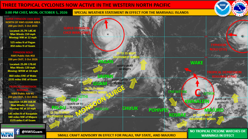
Photo Sources: U.S. National Weather Services Guam
By Christopher Cottrell
October 6, 2026, Marshall Islands__Tropical Depression Koguma might menace the Marshall Islands, with the U.S. National Weather Service putting out a special weather statement Monday as it also monitors Super Typhoon Choi-Wan in the Marianas, Typhoon Nolo near Wake Island, and a monsoon surge across Palau, Yap State, and Mariannas.
According to the weather statement, “Tropical Depression Koguma (27W)… is now the 27th tropical cyclone in the western North Pacific in 2026. NWS Guam is now issuing 6-hourly Public Advisories on Koguma. At this time, tropical storm force winds are not anticipated at any of the designated Tropical Cyclone Warning Points (Enewetak, Ujae, Kwajalein, Wotje, Utirik, Ailinglaplap, Majuro, Jaluit or Mili), therefore, there are no tropical storm watches or warnings in effect at this time.”
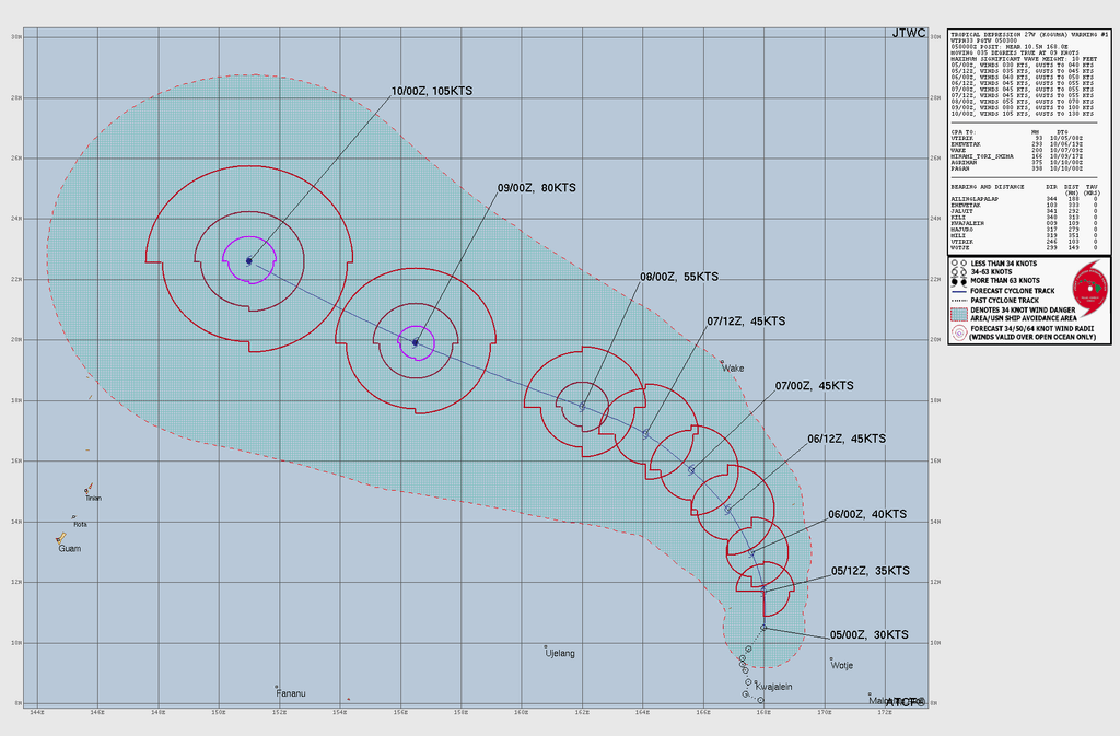
It adds, “As currently forecast, Koguma will pass southwest of Wake Island as it continues northwestward through the open waters between the Marianas and Wake Island. Koguma is expected to keep well northeast of the Marianas as it remains out to sea, well northeast of the CNMI this weekend. However, as long as it remains in the region, keep aware of its evolution.”
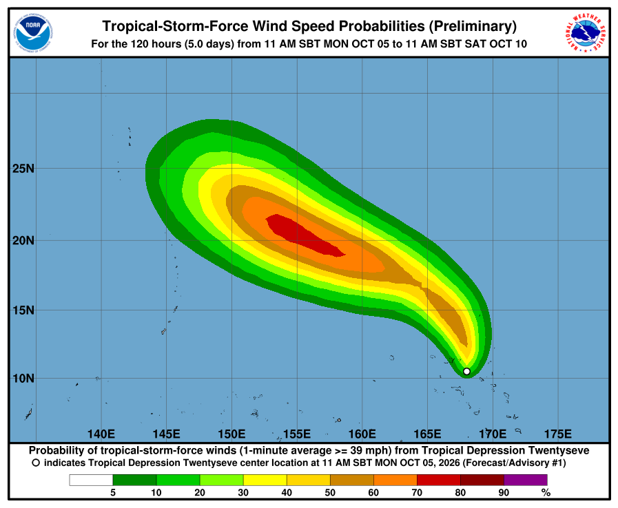
However, it will bring, “strong gusty winds, showers, thunderstorms, locally heavy rainfall and hazardous sea and surf conditions the next couple of days. Satellite-derived sea-surface winds indicate sustained winds of 15 to 25 knots across much of the RMI, including islands and atolls of the Ralik and Ratak chains south of 10N, with gusts up to 30 knots.”
Residents are urged to follow WSO Majuro and the National Disaster Management Office Majuro at: weather.gov/gum/publicforecasts.
Meanwhile in the north Pacific Hurricane Nolo crossed the Date Lane and is now category 3 “Typhoon Nolo”, posing no threats to Wake Island, Guam and CNMI. Also, category 4 Super Typhoon Choi-Wan at 150 mph is curving northeast today, combining its powerful wind field and a monsoon surge that will impact Palau, Yap State and Marianas, “with showers, thunderstorms and strong gusty winds enveloping much of the region,” according to the NWS Guam.