 Micronesia Sun Bright News from the Deep Pacific
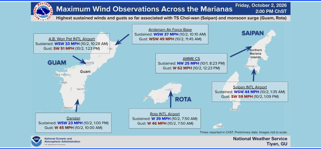
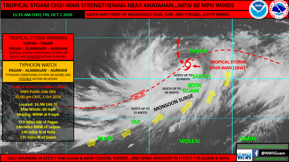
Photo Sources: U.S. National Weather Service Guam
By Christopher Cottrell
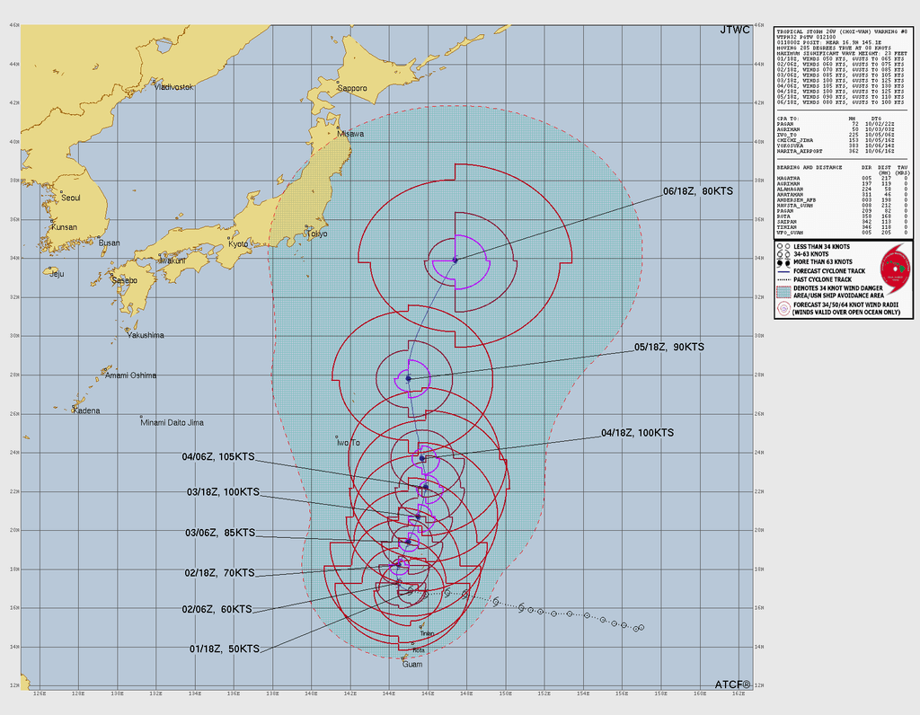
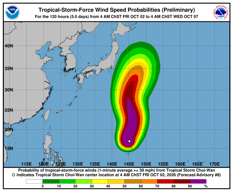
October 2, 2026, Federated States of Micronesia___ Tropical Storm Choi-wan is going to have a compound effect as it turns north away from Guam, Rota, Tinian and Saipan, yet slow down leaving hisgh speed winds in its wake, according to the U.S. National Weather Service Guam.
Watch their latest broadcast here.
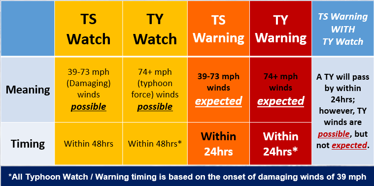
They state, “This will keep the heavy weather conditions across the islands through tonight. Tropical storm force winds (sustained winds of 39 mph) have been observed at the Saipan and Tinian airports, with gusts nearing 60 mph. Gale Warnings and Wind Advisories remain in effect for Guam and Rota, and the adjacent coastal waters.”
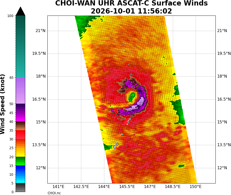
It continues, “A dry slot (the drier area between rainbands) has persisted over Tinian and Saipan the last several hours this morning, while rainbands have brought showers and stronger winds to Rota and Guam. When rainbands are near, expect stronger winds and potentially heavy showers, and when between rainbands, less weather and less-intense winds.”
For the Marianas, “these conditions are expected to continue through Saturday afternoon, October 3, 2026, before slowly easing up into next week. The monsoon surge will continue the elevated winds and shower potential, so remain vigilant on the roads and stay indoors if possible. Saipan and Tinian remain in a Tropical Storm Warning (TS winds of 39-73 MPH occurring) whereas Guam and Rota are still in a Wind Advisory (SW winds of 25-35 MPH with gusts to 50 MPH expected until 4 AM ChST Sunday, October 4, 2026).”
U.S. National Weather Service Guam advises to maintain monitoring at: weather.gov/gum/cyclones.